Situated in a mountainous landscape of South Africa, the Rhebok Trail is a structured multi–day hiking route that moves through high–altitude terrain, open slopes, valleys, and remote natural areas. The trail is known for long walking days, limited infrastructure, and strong exposure to weather, making it an example of endurance–based mountain hiking rather than casual outdoor walking.
Geographic Location and Landscape Setting
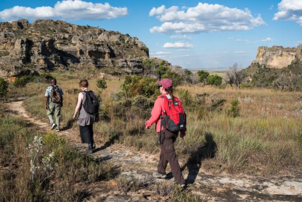
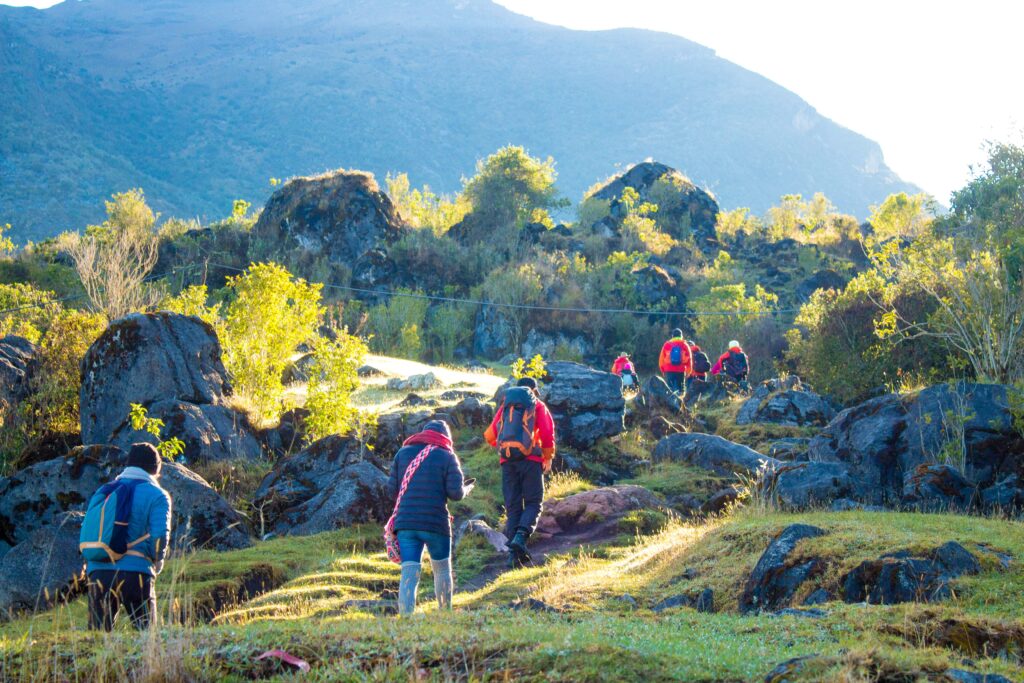
Rhebok Trail is in a mountain area with big valleys, high plateaus, and long ridges. The trail goes through open land; plants stay low, and there are few trees. This makes for a wide view but also strong wind and sun.
Elevation changes define the trail character. Walkers move between lower valleys and higher ground repeatedly across days. Slopes are gradual in some sections and steep in others, depending on natural land shape rather than constructed paths.
The place feels far away. There aren’t many human–made structures, and the sounds of nature are what you hear the most. There are water sources, but they are spread out and often follow natural drainage lines and streams that only flow in certain seasons.
The terrain reflects long–term natural processes rather than managed park design. Paths follow existing land contours and animal movement lines rather than engineered walkways.
Route Structure and Daily Stages of the Rhebok Trail
The Rhebok Trail follows a multi–day format with fixed overnight points. Each day involves extended walking time and consistent elevation change. Distances are planned to balance terrain difficulty with daylight availability rather than speed.
Daily stages differ in focus. Some days emphasize ascent toward higher ground, while others move across plateaus or descend into valleys. The trail does not repeat the same parts; walkers go forward each day.
Navigation is mostly easy, but you need good visibility. Weather like mist or strong wind makes finding your way harder. Trail signs are few, not many.
Main route characteristics include:
- Long daily distances across open mountain terrain
- Fixed overnight stops without alternative shortcuts
- Natural surfaces with limited constructed support
This structure requires steady pacing and careful energy management rather than rapid movement.
Climate Conditions and Weather Exposure
Weather plays a major role on the Rhebok Trail. Mountain conditions change quickly. Clear mornings can shift to wind, cloud, or rain within hours. Temperature change between day and night is normal.
The sun is strong because the land is open and high. Shade is few, and wind makes you lose more water. Cold can come fast, even if it’s not winter.
Rain affects trail surfaces and water availability. Wet ground becomes slippery, and river crossings may become more difficult. Wind chill lowers perceived temperature and increases fatigue.
Weather planning is essential. Clothing layers, wind protection, and timing decisions influence safety and comfort.
Physical Demands and Endurance Requirements
The Rhebok Trail needs strong endurance. Walkers carry gear for many days and walk a long time with few rests. Different ground makes muscles more tired.
Going up and down hills adds more strain. Climbing makes the heart beat fast; going down makes joints and balance work hard. Many days of repetition make tiredness stronger.
Mind also tired. Open land looks the same; isolation makes pressure in the head. Decisions are important all the time on the trail.
Key physical demands include:
- Extended daily walking time over uneven ground
- Repeated elevation gain and loss
- Load carrying with limited recovery time
Basic mountain hiking experience supports safe movement, but advanced technical skills are not required.
Environmental Conditions and Natural Features

Nature along the Rhebok Trail shows mountain grass and bush systems. Plants stay low because of wind and animals eating. The color of slopes changes with the rain season.
Animals live here, but not many big ones. Small mammals, birds and insects are more normal. See, animals depend on the time of day and weather.
Water sources are natural and untreated. Streams may dry during dry periods, while rainfall increases flow quickly. Water planning remains important.
The environment feels unchanged by modern development. This supports ecological continuity but increases responsibility for self–management.
Access Control and Trial Use Rules
Access to the Rhebok Trail follows defined rules to protect the environment and ensure safety. Group size limits apply, and walkers must follow assigned schedules. Overnight locations are fixed and cannot be changed freely.
Movement outside the trail corridor is discouraged. Erosion risk grows fast in mountains, mostly on steep hills. Stay on the trail to help reduce damage.
Trail use needs low impact. Trash follows the rule–carry out all. Fire use is restricted due to grassland sensitivity.
These rules support long–term trail viability rather than user convenience.
Safety Considerations and Risk Awareness
Safety on the Rhebok Trail depends on preparation and judgment. Emergency assistance may take time due to remoteness. Communication coverage is unreliable.
Common risks include weather exposure, dehydration, fatigue, and navigation error. Early response to discomfort prevents escalation.
Walking speed should adjust to conditions. Wind, heat, or cold all affect energy use. Conservative decision–making reduces risk accumulation.
Group awareness matters. Physical condition varies among walkers, and pace must match the slowest member to maintain safety.